Services

Geographic Information Systems (GIS)

Geographic Information Systems (GIS)


  • General consulting.
  • Planning and Implementation.
  • Data development (digitizing, parcel mapping, field collection, etc.).
  • Data processing and manipulation (coordinate conversion, resolution resampling, format convers...

    Read More
Application Development

Application Development


  • ArcGIS Server
  • Google Maps and Open Street Maps
  • Open Source Geospatial Solutions
  • Desktop GIS application development and customization

Read More
Global Positioning Systems (GPS)

Global Positioning Systems (GPS)


  • Millimeter and Centimeter-level to sub-meter spatial accuracy
  • Feature mapping (catch basins, hydrants, signs, utilities, etc.)
  • Ground control point (GCP) collection
  • Offset technology

Read More
Training

Training


  • Software (ESRI ArcGIS, Exelis ENVI, and ERDAS IMAGINE)
  • Application-based training (GPS theory and practice, Image interpretation, etc.)
  • Custom course development

Read More
Technical Workshops

Technical Workshops


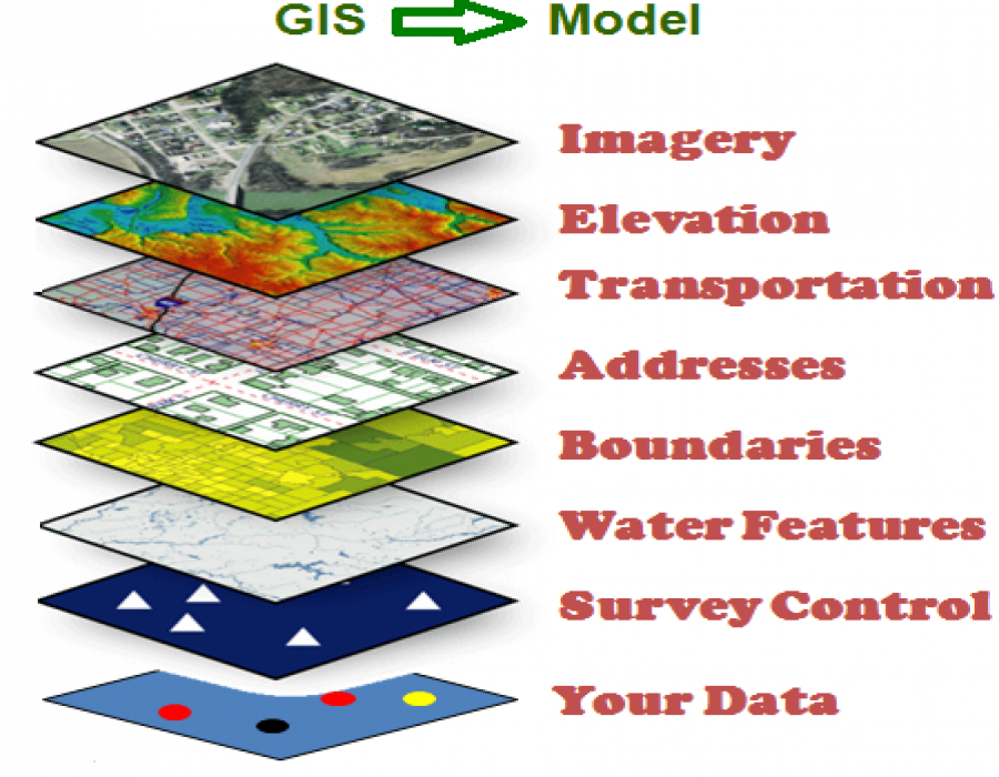
Would you like to train your entire staff? We would be happy to schedule private training (workshops) for you either at ARS&GIS center or your location. We can even tailor the workshops around your specific needs. Please contact us for more in...

Read More